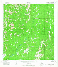
1952 Map of Unalakleet A-3
USGS Topo · Published 1967About this map
The Yellow River winds through this interior Alaskan landscape, characterized by intricate drainage patterns and significant elevation changes across the North Boundary Seward Meridian. This 1952 topographic study, compiled from 1951 aerial photography, reveals a remote wilderness devoid of roads or trails, where the land's character is defined entirely by its watercourses and ridgelines. Waterways like Canyon Creek and Simon Creek carve through the northern terrain, while Grayling Creek dominates the southeastern sector. The absence of human-made infrastructure emphasizes the area's role as a natural corridor before later development. For researchers of Alaskan geography, the map provides a baseline of the regional hydrology and terrain before modern environmental shifts or infrastructure projects altered the flow of these primary tributaries.
Find a feature on this map
6 named features on this map. Tap any name to fly to it.
Don’t see what you’re looking for? This feature index may not catch every label — zoom into the map to look around manually.
Map Details
Editions of this 1952 Unalakleet A-3 Map
2 editions found
Other maps of this area

1951 · Unalakleet
USGS Topo · 1:250,000

1951 · Holy Cross
USGS Topo · 1:250,000

1952 · Unalakleet A-2
USGS Topo · 1:63,360

1952 · Unalakleet A-4
USGS Topo · 1:63,360

1952 · Unalakleet A-3
USGS Topo · 1:63,360

1952 · Unalakleet B-4
USGS Topo · 1:63,360

1952 · Holy Cross D-4
USGS Topo · 1:63,360

1952 · Holy Cross D-2
USGS Topo · 1:63,360

1952 · Holy Cross D-3
USGS Topo · 1:63,360

1952 · Unalakleet B-3
USGS Topo · 1:63,360