
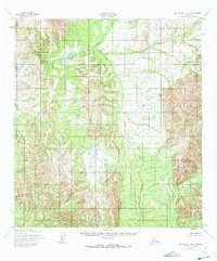
1952 Map of Unalakleet B-3
USGS Topo · Published 1959About this map
Anvik River headwaters wind through this interior Alaskan wilderness, captured during a 1951 aerial survey and field-annotated just after the war. The landscape is dominated by the prominent Mt McDonald and the high drainage basins of McDonald Creek and Thompson Creek. This survey, produced by the Army Map Service and published for civil use, illustrates a roadless terrain of dramatic elevation shifts and dense vegetation patterns. Without established settlements or trails, the map focuses on the complex hydrology and topography that dictated movement through the Yukon-Koyukuk region before modern development. It serves as a precise record of a mountain landscape defined by natural boundaries rather than human infrastructure.
Find a feature on this map
4 named features on this map. Tap any name to fly to it.
Don’t see what you’re looking for? This feature index may not catch every label — zoom into the map to look around manually.
Map Details
Editions of this 1952 Unalakleet B-3 Map
2 editions found
Other maps of this area

1951 · Unalakleet
USGS Topo · 1:250,000

1952 · Unalakleet A-2
USGS Topo · 1:63,360

1952 · Unalakleet A-4
USGS Topo · 1:63,360

1952 · Unalakleet A-3
USGS Topo · 1:63,360

1952 · Unalakleet C-2
USGS Topo · 1:63,360

1952 · Unalakleet B-4
USGS Topo · 1:63,360

1952 · Unalakleet C-3
USGS Topo · 1:63,360

1952 · Unalakleet C-4
USGS Topo · 1:63,360

1952 · Unalakleet B-2
USGS Topo · 1:63,360

1952 · Unalakleet
USGS Topo · 1:250,000