
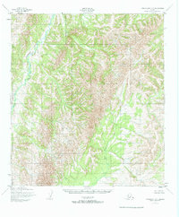
1952 Map of Unalakleet C-3
USGS Topo · Published 1959About this map
Chiroskey River winds through the northwestern reaches of this interior Alaskan landscape, which was mapped in detail by the Army Map Service during the early 1950s. The terrain is defined by its complex drainage patterns and significant elevation changes, captured through photogrammetric methods from 1951 aerial photography. A notable administrative boundary bisects the region, marking the line between the Second Judicial Division and the Fourth Judicial Division. This demarcation serves as a primary point of reference in an otherwise undeveloped territory, where no roads or trails were recorded at the time of the survey. The map illustrates the wilderness as it appeared before major modern infrastructure, focusing on the natural geography and the territorial administrative divisions that governed this remote part of the Alaska territory.
Find a feature on this map
4 named features on this map. Tap any name to fly to it.
Don’t see what you’re looking for? This feature index may not catch every label — zoom into the map to look around manually.
Map Details
Editions of this 1952 Unalakleet C-3 Map
2 editions found
Other maps of this area

1950 · Unalakleet D-3
USGS Topo · 1:63,360

1950 · Unalakleet D-4
USGS Topo · 1:63,360

1951 · Unalakleet
USGS Topo · 1:250,000

1952 · Unalakleet C-2
USGS Topo · 1:63,360

1952 · Unalakleet B-4
USGS Topo · 1:63,360

1952 · Unalakleet D-2
USGS Topo · 1:63,360

1952 · Unalakleet C-4
USGS Topo · 1:63,360

1952 · Unalakleet B-3
USGS Topo · 1:63,360

1952 · Unalakleet B-2
USGS Topo · 1:63,360

1952 · Unalakleet
USGS Topo · 1:250,000