
1952 Map of Unalakleet D-2
USGS Topo · Published 1959About this map
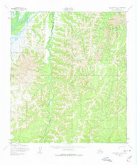
Old Woman River meanders through this interior Alaskan landscape, a region defined by its seasonal movement and administrative boundaries in the early 1950s. The map illustrates the convergence of the Unalakleet River and its tributaries, showing the topographic reality of the terrain before modern infrastructure reached this part of the Nome region. A significant historical detail is the Winter Trail, which underscores the reliance on traditional routes through the river valleys during the colder months. This survey also records the boundary line between the Second Judicial Division and the Fourth Judicial Division, reflecting the mid-century legal geography of the territory. The map's detailed contouring and drainage patterns reveal how the river systems served as the primary corridors for travel and mapping efforts conducted by the Corps of Engineers.
Find a feature on this map
5 named features on this map. Tap any name to fly to it.
Don’t see what you’re looking for? This feature index may not catch every label — zoom into the map to look around manually.
Map Details
Editions of this 1952 Unalakleet D-2 Map
3 editions found
Other maps of this area

1948 · Norton Bay
USGS Topo · 1:250,000

1950 · Unalakleet D-3
USGS Topo · 1:63,360

1950 · Norton Bay A-3
USGS Topo · 1:63,360

1951 · Unalakleet
USGS Topo · 1:250,000

1951 · Norton Bay
USGS Topo · 1:250,000

1952 · Unalakleet C-2
USGS Topo · 1:63,360

1952 · Unalakleet C-3
USGS Topo · 1:63,360

1952 · Unalakleet C-1
USGS Topo · 1:63,360

1952 · Unalakleet D-1
USGS Topo · 1:63,360

1952 · Unalakleet
USGS Topo · 1:250,000