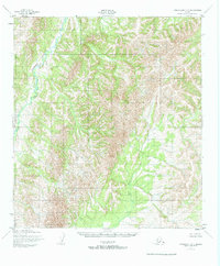
1952 Map of Unalakleet C-3
USGS Topo · Published 1965About this map
The Chiroskey River winds through the northwestern reaches of this remote interior landscape, illustrating the complex drainage patterns of the Yukon-Koyukuk region in the early 1950s. Surveyed by the Army Map Service using aerial photography, the terrain is characterized by intricate contour lines that reveal the high-elevation divide between major western Alaskan watersheds. In the southeastern corner, the upper reaches of the Anvik River begin to take shape, eventually feeding toward the Yukon. The lack of any marked roads, trails, or settlements highlights the wilderness character of the area during this era of mapping, where natural waterways served as the primary landmarks for navigation and land management by the Bureau of Land Management.
Find a feature on this map
2 named features on this map. Tap any name to fly to it.
Don’t see what you’re looking for? This feature index may not catch every label — zoom into the map to look around manually.
Map Details
Editions of this 1952 Unalakleet C-3 Map
2 editions found
Other maps of this area

1950 · Unalakleet D-3
USGS Topo · 1:63,360

1950 · Unalakleet D-4
USGS Topo · 1:63,360

1951 · Unalakleet
USGS Topo · 1:250,000

1952 · Unalakleet C-2
USGS Topo · 1:63,360

1952 · Unalakleet B-4
USGS Topo · 1:63,360

1952 · Unalakleet D-2
USGS Topo · 1:63,360

1952 · Unalakleet C-3
USGS Topo · 1:63,360

1952 · Unalakleet C-4
USGS Topo · 1:63,360

1952 · Unalakleet B-3
USGS Topo · 1:63,360

1952 · Unalakleet B-2
USGS Topo · 1:63,360