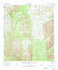
1952 Map of Unalakleet B-3
USGS Topo · Published 1973About this map
Anvik River meanders through the northwestern portion of this 1950s study area, carving a distinct valley through the interior of the Yukon-Koyukuk region. The landscape is characterized by a high concentration of unnamed peaks and drainage systems, where Mt McDonald stands as the primary named landmark. This survey, mapped by the Army Map Service using 1951 aerial photography, captures the territory before modern development or infrastructure reached this part of the Alaskan wilderness. The presence of McDonald Creek and Thompson Creek indicates a complex hydrological network that defines the local topography, yet the absence of roads, trails, or permanent structures on the sheet highlights the isolated nature of the terrain during this era. Land lines shown here represent unsurveyed locations predetermined by the Bureau of Land Management, reflecting a time when much of the interior remained largely uncharted on the ground.
Find a feature on this map
4 named features on this map. Tap any name to fly to it.
Don’t see what you’re looking for? This feature index may not catch every label — zoom into the map to look around manually.
Map Details
Editions of this 1952 Unalakleet B-3 Map
2 editions found
Other maps of this area

1951 · Unalakleet
USGS Topo · 1:250,000

1952 · Unalakleet A-2
USGS Topo · 1:63,360

1952 · Unalakleet A-4
USGS Topo · 1:63,360

1952 · Unalakleet A-3
USGS Topo · 1:63,360

1952 · Unalakleet C-2
USGS Topo · 1:63,360

1952 · Unalakleet B-4
USGS Topo · 1:63,360

1952 · Unalakleet C-3
USGS Topo · 1:63,360

1952 · Unalakleet C-4
USGS Topo · 1:63,360

1952 · Unalakleet B-3
USGS Topo · 1:63,360

1952 · Unalakleet B-2
USGS Topo · 1:63,360