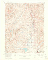
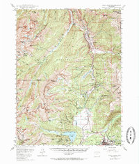
1949 Map of Holy Cross
USGS Topo · Published 1966About this map
Camp Hale Military Reservation dominates the high-altitude landscape of the northern Eagle River valley, serving as a primary training ground during the mid-20th century. To the south, the industrial heritage of the Rockies is represented by Leadville and its surrounding mining landscape, where researchers can identify the Tiger Shaft, Nelson Tunnel, and the famous Matchless Mine. The Denver and Rio Grande Western railroad snakes through the valleys, connecting the settlements of Pando and Mitchell while crossing the Continental Divide at Tennessee Pass. The western portion of the map is defined by the high peaks of the White River National Forest, including the iconic Mt of the Holy Cross and the nearby Bowl of Tears. This survey captures a moment when the region's 19th-century mining origins, such as Holy Cross City, were being overlaid by modern military and aviation infrastructure like the Leadville Landing Field.
Find a feature on this map
111 named features on this map. Tap any name to fly to it.
Don’t see what you’re looking for? This feature index may not catch every label — zoom into the map to look around manually.
Map Details
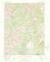
Editions of this 1949 Holy Cross Map
7 editions found

Other maps of this area

1889 · Leadville
USGS Topo · 1:125,000

1891 · Leadville
USGS Topo · 1:125,000

1909 · Mount Jackson
USGS Topo · 1:125,000

1911 · Mount Jackson
USGS Topo · 1:125,000

1929 · Dillon
USGS Topo · 1:62,500

1934 · Climax
USGS Topo · 1:48,000

1934 · Minturn
USGS Topo · 1:62,500

1934 · Dillon
USGS Topo · 1:62,500

1935 · Mount Elbert
USGS Topo · 1:62,500

1938 · Mt. Lincoln
USGS Topo · 1:48,000