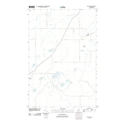
2010 Map of Holyoke
USGS Topo · Published 2010About this map
Holyoke and Nickerson serve as the primary human anchors in this northeastern Minnesota landscape, which is defined by an intricate network of waterways and glacial lakes. The Holyoke Post Office marks the center of local life, while the surrounding territory is shaped by the drainage patterns of the Nemadji River and its South Fork. Significant water bodies such as Net Lake, Graham Lake, and Cranberry Lake punctuate the wooded terrain, suggesting a region heavily influenced by seasonal recreation and conservation.
Find a feature on this map
39 named features on this map. Tap any name to fly to it.
Don’t see what you’re looking for? This feature index may not catch every label — zoom into the map to look around manually.
Map Details
Editions of this 2010 Holyoke Map
This is the sole edition of this map. No revisions or reprints were ever made.
Other maps of this area

1949 · Holyoke
USGS Topo · 1:48,000

1953 · Duluth
USGS Topo · 1:250,000

1954 · Foxboro
USGS Topo · 1:24,000

1954 · Wrenshall
USGS Topo · 1:24,000

1954 · Frogner
USGS Topo · 1:24,000

1954 · Atkinson
USGS Topo · 1:24,000

1956 · Barnum
USGS Topo · 1:62,500

1958 · Duluth
USGS Topo · 1:250,000

1962 · Holyoke
USGS Topo · 1:62,500

1962 · Bruno
USGS Topo · 1:62,500