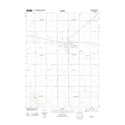
2013 Map of Holyoke
USGS Topo · Published 2013About this map
Holyoke serves as the central hub of this agricultural landscape in northeastern Colorado, where the town grid is established along the intersection of local routes and the courses of Frenchman Creek. The township is defined by a dense network of county roads, such as Co Road 26 and Co Road 14, which organize the High Plains terrain into a clear rectilinear pattern. This systematic division of land supports the region's farming infrastructure, visible in the way the town core branches out from W Denver Ave and E Denver St. Beyond the residential and commercial blocks, the landscape features the Holyoke Memorial Park and the Holyoke Airport, while the northern reaches are drained by the North Fork Frenchman Creek and the S Fork Frenchman Cr. To the southwest, Goddard Peak provides a rare point of elevation in an otherwise steadily graded prairie environment.
Find a feature on this map
51 named features on this map. Tap any name to fly to it.
Don’t see what you’re looking for? This feature index may not catch every label — zoom into the map to look around manually.
Map Details
Editions of this 2013 Holyoke Map
This is the sole edition of this map. No revisions or reprints were ever made.
Other maps of this area
1954 · Sterling
USGS Topo · 1:250,000
1958 · Sterling
USGS Topo · 1:250,000
1962 · Holyoke NE
USGS Topo · 1:24,000
1962 · Amherst
USGS Topo · 1:24,000
1962 · Holyoke NW
USGS Topo · 1:24,000
1971 · Paoli
USGS Topo · 1:24,000
1971 · Amherst SW
USGS Topo · 1:24,000
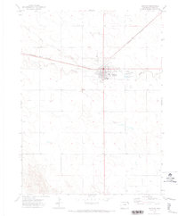
1971 · Holyoke
USGS Topo · 1:24,000
1971 · Alvin NW
USGS Topo · 1:24,000
1971 · Fiddler Peak
USGS Topo · 1:24,000