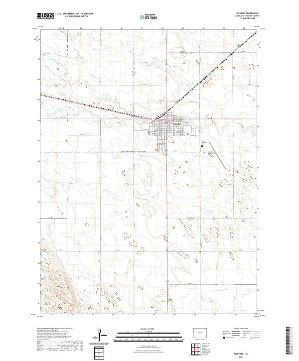
2022 Map of Holyoke
USGS Topo · Published 2022About this map
Holyoke serves as the focal point of this high plains agricultural landscape in Phillips County. The town is organized on a distinct grid, anchored by the Phillips County Courthouse and extending south toward the Holyoke Airport and the Holyoke Memorial Park. The surrounding terrain is defined by the subtle drainage patterns of Frenchman Cr, including its northern and southern forks. This hydrological network, featuring the N Fork Frenchman Cr and South Fork Frenchman Creek, carves low-relief valleys through a vast expanse of section lines and rural roads. To the southwest, the elevation rises slightly at Goddard Peak, one of the few named topographic landmarks in an area otherwise dominated by the orderly arrangement of township and range boundaries.
Find a feature on this map
53 named features on this map. Tap any name to fly to it.
Don’t see what you’re looking for? This feature index may not catch every label — zoom into the map to look around manually.
Map Details
Editions of this 2022 Holyoke Map
This is the sole edition of this map. No revisions or reprints were ever made.
Other maps of this area

1954 · Sterling
USGS Topo · 1:250,000

1958 · Sterling
USGS Topo · 1:250,000

1962 · Holyoke NE
USGS Topo · 1:24,000

1962 · Amherst
USGS Topo · 1:24,000

1962 · Holyoke NW
USGS Topo · 1:24,000

1971 · Paoli
USGS Topo · 1:24,000

1971 · Amherst SW
USGS Topo · 1:24,000

1971 · Holyoke
USGS Topo · 1:24,000

1971 · Alvin NW
USGS Topo · 1:24,000

1971 · Fiddler Peak
USGS Topo · 1:24,000