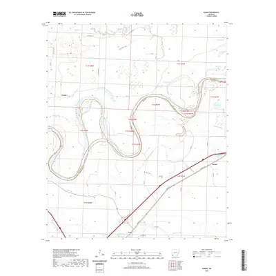
2020 Map of Homan
USGS Topo · Published 2020About this map
The winding Red River defines this riverine landscape at the border of Miller and Little River counties. The complex hydrology of the floodplain is evident in the many oxbows and remnant water bodies like Horseshoe Lake, Old River Lake, and Tobe Lake. The settlement at Homan serves as a local anchor along East Broad Street, while the small community of Paup sits further south near Paup Cemetery. This area reflects a long history of water management and agricultural land use, with features like Gillespie Ditch and Homan Ditch draining the low-lying terrain near Bois d'Arc Bayou. Transportation is oriented toward the river crossings and rural routes like Little River 295 Road and LR 70, which connect the scattered homesteads of Temple and the surrounding bottomlands.
Find a feature on this map
43 named features on this map. Tap any name to fly to it.
Don’t see what you’re looking for? This feature index may not catch every label — zoom into the map to look around manually.
Map Details
Editions of this 2020 Homan Map
This is the sole edition of this map. No revisions or reprints were ever made.
Other maps of this area

1909 · Texarkana
USGS Topo · 1:62,500

1950 · Ashdown East
USGS Topo · 1:24,000

1950 · Ogden
USGS Topo · 1:24,000

1950 · Red Bluff
USGS Topo · 1:24,000

1951 · Ogden
USGS Topo · 1:24,000

1951 · Red Bluff
USGS Topo · 1:24,000

1951 · Ashdown East
USGS Topo · 1:24,000

1951 · Homan
USGS Topo · 1:24,000

1951 · Fulton
USGS Topo · 1:24,000

1951 · Mc Nab
USGS Topo · 1:24,000