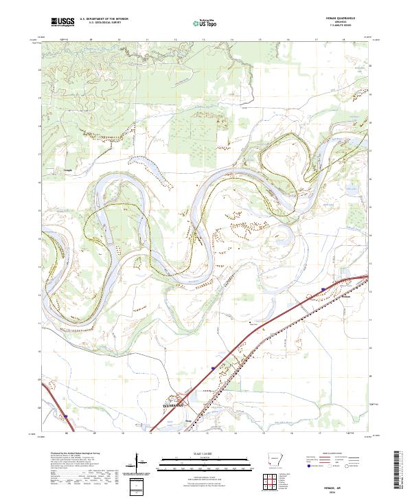
2024 Map of Homan
USGS Topo · Published 2024About this map
The Red River and Little River converge in a complex network of oxbow lakes and meandering channels near the Arkansas-Texas border. This landscape is defined by its shifting waterways, where remnant features like Old River Lake, Young Lake, and Cut-off Lake indicate the historical migration of the riverbed. Low-lying wetlands are crisscrossed by drainage systems such as Gillespie Ditch and Homan Ditch, which support the agricultural character of the surrounding bottomlands.
Find a feature on this map
50 named features on this map. Tap any name to fly to it.
Don’t see what you’re looking for? This feature index may not catch every label — zoom into the map to look around manually.
Map Details
Editions of this 2024 Homan Map
This is the sole edition of this map. No revisions or reprints were ever made.
Other maps of this area

1909 · Texarkana
USGS Topo · 1:62,500

1950 · Ashdown East
USGS Topo · 1:24,000

1950 · Ogden
USGS Topo · 1:24,000

1950 · Red Bluff
USGS Topo · 1:24,000

1951 · Ogden
USGS Topo · 1:24,000

1951 · Red Bluff
USGS Topo · 1:24,000

1951 · Ashdown East
USGS Topo · 1:24,000

1951 · Homan
USGS Topo · 1:24,000

1951 · Fulton
USGS Topo · 1:24,000

1951 · Mc Nab
USGS Topo · 1:24,000