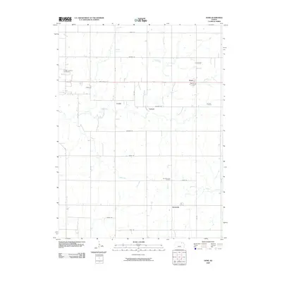
2009 Map of Home
USGS Topo · Published 2009About this map
Home sits at the heart of this Marshall County landscape, where the Pony Express Hwy serves as a primary east-west artery across a grid of local roads named for various tribes and landmarks. The settlement pattern here is sparse but distinct, featuring the smaller communities of Carden, Upland, and Reedsville. These rural hubs are connected by a network including Jayhawk Rd, Navajo Rd, and Pawnee Rd, reflecting the regional heritage through its cartographic nomenclature.
Find a feature on this map
32 named features on this map. Tap any name to fly to it.
Don’t see what you’re looking for? This feature index may not catch every label — zoom into the map to look around manually.
Map Details
Editions of this 2009 Home Map
This is the sole edition of this map. No revisions or reprints were ever made.
Other maps of this area

1889 · Seneca
USGS Topo · 1:125,000

1889 · Marysville
USGS Topo · 1:125,000

1894 · Seneca
USGS Topo · 1:125,000

1894 · Marysville
USGS Topo · 1:125,000

1955 · Manhattan
USGS Topo · 1:250,000

1956 · Manhattan
USGS Topo · 1:250,000

1957 · Manhattan
USGS Topo · 1:250,000

1966 · Oketo
USGS Topo · 1:24,000

1966 · Marysville
USGS Topo · 1:24,000
1966 · Herkimer
USGS Topo · 1:24,000