
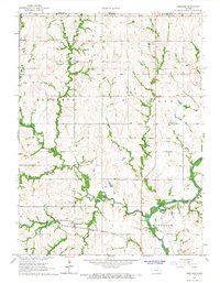
1966 Map of Home
USGS Topo · Published 1967About this map
The Union Pacific railroad corridor serves as the primary axis for this Marshall County landscape, connecting the small settlements of Home and Carden. This mid-century survey reveals a rural society structured around several distinct townships, including Marysville Franklin and Elm Creek Center. The drainage patterns of Spring Creek and Lily Creek dictate the local topography, carving paths through the agricultural fields and leading toward the smaller community of Reedsville in the south.
Find a feature on this map
23 named features on this map. Tap any name to fly to it.
Don’t see what you’re looking for? This feature index may not catch every label — zoom into the map to look around manually.
Map Details
Editions of this 1966 Home Map
This is the sole edition of this map. No revisions or reprints were ever made.
Other maps of this area

1889 · Seneca
USGS Topo · 1:125,000

1889 · Marysville
USGS Topo · 1:125,000

1894 · Seneca
USGS Topo · 1:125,000

1894 · Marysville
USGS Topo · 1:125,000

1955 · Manhattan
USGS Topo · 1:250,000

1956 · Manhattan
USGS Topo · 1:250,000

1957 · Manhattan
USGS Topo · 1:250,000

1966 · Oketo
USGS Topo · 1:24,000

1966 · Marysville
USGS Topo · 1:24,000
1966 · Herkimer
USGS Topo · 1:24,000