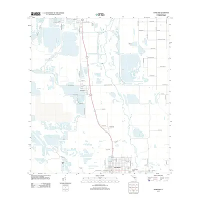
2012 Map of Homeland
USGS Topo · Published 2012About this map
The Peace River corridor in Polk County defines this landscape, winding through a region shaped by both natural waterways and heavy industrial activity. Fort Meade anchors the southern portion of the sheet with its established street grid, while the smaller settlements of Homeland and Pembroke sit further north. The area is marked by significant topographic changes from phosphate mining history, most notably the Noralyn Mine Lake and the wetlands around Tiger Bay. Genealogists will find three distinct burial sites within this quadrangle: Evergreen Cem, Hancock Cem, and the more northern Peace Creek Cem. Cultural and infrastructure landmarks are well-represented, from the Po in Fort Meade to the John Singletary Bridge crossing the river, alongside numerous family-named roads like Albritton Rd and Weita Rd that suggest long-standing local landownership patterns.
Find a feature on this map
72 named features on this map. Tap any name to fly to it.
Don’t see what you’re looking for? This feature index may not catch every label — zoom into the map to look around manually.
Map Details
Editions of this 2012 Homeland Map
This is the sole edition of this map. No revisions or reprints were ever made.
Other maps of this area

1949 · Mulberry
USGS Topo · 1:24,000

1949 · Bartow
USGS Topo · 1:24,000

1949 · Bradley Junction
USGS Topo · 1:24,000

1950 · Mulberry
USGS Topo · 1:24,000

1950 · Bartow
USGS Topo · 1:24,000

1950 · Bradley Junction
USGS Topo · 1:24,000

1952 · Homeland
USGS Topo · 1:24,000

1955 · Eloise
USGS Topo · 1:24,000

1955 · Bowling Green
USGS Topo · 1:24,000

1955 · Baird
USGS Topo · 1:24,000