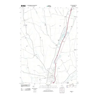
2010 Map of Homer
USGS Topo · Published 2010About this map
The West Branch Tioughnioga River carves a central valley through this section of Cortland County, anchoring a chain of glacial waters including Upper Little York Lake, Lower Little York Lake, Goodale Lake, and Green Lake. The village of Homer sits at the southern confluence where the river meets the East Branch Tioughnioga River and Factory Brook. This landscape is defined by its prominent hills, such as Mount Toppin and Cosmos Hill, which rise above the interconnected agricultural and residential settlements. Genealogists will find several burial grounds documented here, from the large Glenwood Cemetery near the village center to more remote sites like the Sessions Hill Neighborhood Cemetery. Small crossroads and named locales like Slab City, Little York, and Baltimore provide evidence of historical community nodes along the valley floor, while roads like Military RD and Hewitt RD hint at earlier transportation corridors through the highlands.
Find a feature on this map
85 named features on this map. Tap any name to fly to it.
Don’t see what you’re looking for? This feature index may not catch every label — zoom into the map to look around manually.
Map Details
Editions of this 2010 Homer Map
This is the sole edition of this map. No revisions or reprints were ever made.
Other maps of this area

1898 · Moravia
USGS Topo · 1:62,500

1899 · Skaneateles
USGS Topo · 1:62,500

1900 · Tully
USGS Topo · 1:62,500

1902 · Skaneateles
USGS Topo · 1:62,500

1902 · Moravia
USGS Topo · 1:62,500

1903 · Cortland
USGS Topo · 1:62,500

1942 · Groton
USGS Topo · 1:24,000

1943 · Spafford
USGS Topo · 1:31,680

1943 · Groton
USGS Topo · 1:31,680

1943 · Otisco Valley
USGS Topo · 1:31,680