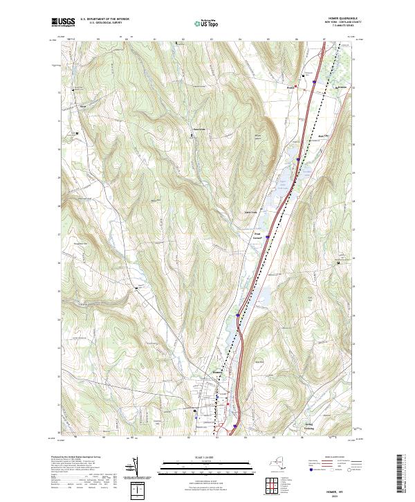
2023 Map of Homer
USGS Topo · Published 2023About this map
The West Branch Tioughnioga River carves a central corridor through the landscape, anchoring a valley of glacial lakes and small-town settlements. Homer serves as the primary hub at the southern edge, where the river meets Factory Brook near Glenwood Cem. The surrounding hills, including Mount Toppin and Preble Hill, are defined by a network of rural roads and numerous family and neighborhood burial grounds such as the Sessions Hill Neighborhood Cem.
Find a feature on this map
122 named features on this map. Tap any name to fly to it.
Don’t see what you’re looking for? This feature index may not catch every label — zoom into the map to look around manually.
Map Details
Editions of this 2023 Homer Map
This is the sole edition of this map. No revisions or reprints were ever made.
Other maps of this area

1898 · Moravia
USGS Topo · 1:62,500

1899 · Skaneateles
USGS Topo · 1:62,500

1900 · Tully
USGS Topo · 1:62,500

1902 · Skaneateles
USGS Topo · 1:62,500

1902 · Moravia
USGS Topo · 1:62,500

1903 · Cortland
USGS Topo · 1:62,500

1942 · Groton
USGS Topo · 1:24,000

1943 · Spafford
USGS Topo · 1:31,680

1943 · Groton
USGS Topo · 1:31,680

1943 · Otisco Valley
USGS Topo · 1:31,680