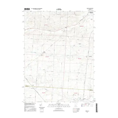
2016 Map of Homer
USGS Topo · Published 2016About this map
Homer sits at the southern edge of this terrain, where the North Fork Licking River and Goose Run converge. The landscape is defined by a dense network of country roads and small settlements like Brandon, Lock, and Bangs, which maintain their character alongside larger infrastructure such as the Knox County Airport. For genealogists, the map is particularly rich in family and community burial grounds, ranging from the central Miller Cem and Bird Cem to the Simmons Cem near the Licking County line. The drainage pattern is intricate, with Sycamore Cr, Vance Cr, and Dry Cr cutting through the fields, illustrating the persistent agricultural and rural residential layout of central Ohio in the early 21st century.
Find a feature on this map
95 named features on this map. Tap any name to fly to it.
Don’t see what you’re looking for? This feature index may not catch every label — zoom into the map to look around manually.
Map Details
Editions of this 2016 Homer Map
This is the sole edition of this map. No revisions or reprints were ever made.
Other maps of this area

1908 · Granville
USGS Topo · 1:62,500

1909 · Newark
USGS Topo · 1:62,500

1910 · Granville
USGS Topo · 1:62,500

1912 · Gambier
USGS Topo · 1:62,500

1914 · Gambier
USGS Topo · 1:62,500

1915 · Fredericktown
USGS Topo · 1:62,500

1943 · Gambier
USGS Topo · 1:62,500

1943 · Fredericktown
USGS Topo · 1:62,500

1950 · Marion
USGS Topo · 1:250,000
1961 · Fredonia
USGS Topo · 1:24,000