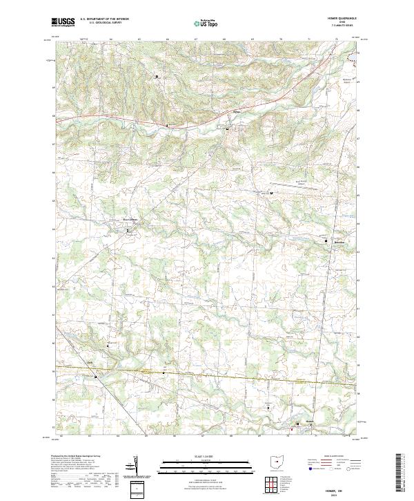
2023 Map of Homer
USGS Topo · Published 2023About this map
The North Fork Licking River winds through the southern landscape of this region, marking a geographical boundary near the Knox Co Licking Co line. Small settlements such as Homer, Lock, and Bangs are connected by a network of rural routes including Columbus Rd and Granville Rd. The area is characterized by numerous small family and community burial grounds, such as Homer Cem and the Five Corners Cem, which provide significant points of interest for genealogical research.
Find a feature on this map
84 named features on this map. Tap any name to fly to it.
Don’t see what you’re looking for? This feature index may not catch every label — zoom into the map to look around manually.
Map Details
Editions of this 2023 Homer Map
This is the sole edition of this map. No revisions or reprints were ever made.
Other maps of this area

1908 · Granville
USGS Topo · 1:62,500

1909 · Newark
USGS Topo · 1:62,500

1910 · Granville
USGS Topo · 1:62,500

1912 · Gambier
USGS Topo · 1:62,500

1914 · Gambier
USGS Topo · 1:62,500

1915 · Fredericktown
USGS Topo · 1:62,500

1943 · Gambier
USGS Topo · 1:62,500

1943 · Fredericktown
USGS Topo · 1:62,500

1950 · Marion
USGS Topo · 1:250,000
1961 · Fredonia
USGS Topo · 1:24,000