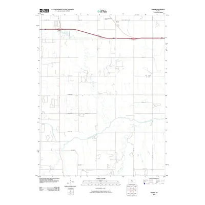
2010 Map of Homer
USGS Topo · Published 2010About this map
Homer sits at the northern edge of this Russell County landscape, a region defined by the winding course of the Smoky Hill River and its numerous tributaries. The terrain is marked by a complex network of waterways, including Landon Creek, Fossil Creek, and Sellens Creek, which carve through the plains south of the Russell Municipal Airport. While much of the land appears as open agricultural space, the presence of the Hall Gurney Oil Field in the eastern portion of the quadrangle highlights the enduring importance of the petroleum industry to the local economy.
Find a feature on this map
32 named features on this map. Tap any name to fly to it.
Don’t see what you’re looking for? This feature index may not catch every label — zoom into the map to look around manually.
Map Details
Editions of this 2010 Homer Map
This is the sole edition of this map. No revisions or reprints were ever made.
Other maps of this area

1896 · Russell
USGS Topo · 1:125,000

1955 · Great Bend
USGS Topo · 1:250,000

1956 · Dorrance SW
USGS Topo · 1:24,000

1957 · Great Bend
USGS Topo · 1:250,000

1958 · Great Bend
USGS Topo · 1:250,000

1961 · Russell SW
USGS Topo · 1:24,000

1961 · Homer
USGS Topo · 1:24,000

1967 · Russell NW
USGS Topo · 1:24,000
1967 · Dorrance NW
USGS Topo · 1:24,000

1967 · Russell
USGS Topo · 1:24,000