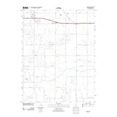
2012 Map of Homer
USGS Topo · Published 2012About this map
The Smoky Hill River meanders across the southern portion of this landscape, carving a wide valley floor defined by numerous small tributaries like Landon Cr and Sellens Cr. The settlement of Homer sits in the northern reaches, positioned near the Russell Municipal Airport and a prominent bend in Cedar Cr. Further west, the terrain transitions into a more developed recreational and residential pocket around Fossil Lake, where the Triple J Camper Park is located.
Find a feature on this map
39 named features on this map. Tap any name to fly to it.
Don’t see what you’re looking for? This feature index may not catch every label — zoom into the map to look around manually.
Map Details
Editions of this 2012 Homer Map
This is the sole edition of this map. No revisions or reprints were ever made.
Other maps of this area

1896 · Russell
USGS Topo · 1:125,000

1955 · Great Bend
USGS Topo · 1:250,000

1956 · Dorrance SW
USGS Topo · 1:24,000

1957 · Great Bend
USGS Topo · 1:250,000

1958 · Great Bend
USGS Topo · 1:250,000

1961 · Russell SW
USGS Topo · 1:24,000

1961 · Homer
USGS Topo · 1:24,000

1967 · Russell NW
USGS Topo · 1:24,000
1967 · Dorrance NW
USGS Topo · 1:24,000

1967 · Russell
USGS Topo · 1:24,000