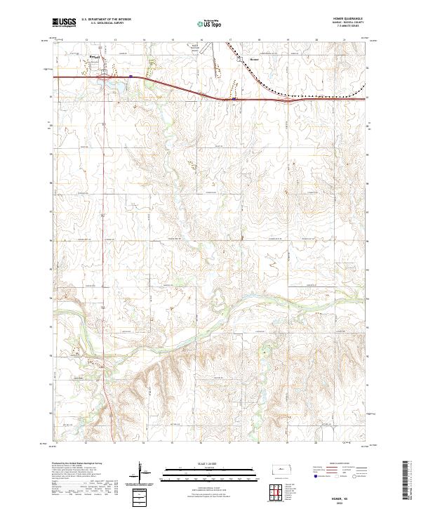
2022 Map of Homer
USGS Topo · Published 2022About this map
Russell and the nearby settlement of Homer anchor this Russell County landscape, where the prairie begins to break toward the drainage of the Smoky Hill River. The river winds through the southern portion of the quadrangle, joined by tributaries such as Landon Cr and Sellens Cr, which carve distinct draws into the surrounding agricultural tablelands. The infrastructure of the area is defined by a rigid section-line road grid, including 4 Corners Rd and Homer Rd, supporting a rural economy centered on the western edge of the Kansas wheat belt. To the north, the Russell Municipal Airport and the course of Fossil Cr mark the interface between the growing town and the open country. This survey illustrates the persistent importance of watercourses and rail-aligned roads in shaping the development of the High Plains.
Find a feature on this map
28 named features on this map. Tap any name to fly to it.
Don’t see what you’re looking for? This feature index may not catch every label — zoom into the map to look around manually.
Map Details
Editions of this 2022 Homer Map
This is the sole edition of this map. No revisions or reprints were ever made.
Other maps of this area

1896 · Russell
USGS Topo · 1:125,000

1955 · Great Bend
USGS Topo · 1:250,000

1956 · Dorrance SW
USGS Topo · 1:24,000

1957 · Great Bend
USGS Topo · 1:250,000

1958 · Great Bend
USGS Topo · 1:250,000

1961 · Russell SW
USGS Topo · 1:24,000

1961 · Homer
USGS Topo · 1:24,000

1967 · Russell NW
USGS Topo · 1:24,000
1967 · Dorrance NW
USGS Topo · 1:24,000

1967 · Russell
USGS Topo · 1:24,000