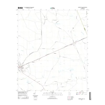
2014 Map of Homerville East
USGS Topo · Published 2014About this map
Homerville serves as the primary hub of this south Georgia landscape, where the town layout meets the sweeping natural drainages of the coastal plain. The eastern edge of the community is defined by a network of local roads and larger thoroughfares like Frank S Sessoms Memorial Hwy and Downing Musgrove Pky, which cut through the piney lowlands. To the east, the map reveals small clusters at Paletree and Traisville, illustrating the traditional corridor-based growth pattern typical of this region.
Find a feature on this map
72 named features on this map. Tap any name to fly to it.
Don’t see what you’re looking for? This feature index may not catch every label — zoom into the map to look around manually.
Map Details
Editions of this 2014 Homerville East Map
This is the sole edition of this map. No revisions or reprints were ever made.
Other maps of this area

1953 · Waycross
USGS Topo · 1:250,000

1954 · Valdosta
USGS Topo · 1:250,000

1958 · Valdosta
USGS Topo · 1:250,000

1958 · Waycross
USGS Topo · 1:250,000

1959 · Valdosta
USGS Topo · 1:250,000

1967 · Spooner
USGS Topo · 1:24,000

1967 · Pine Valley
USGS Topo · 1:24,000

1968 · Homerville East
USGS Topo · 1:24,000

1968 · Midway
USGS Topo · 1:24,000

1968 · Manor
USGS Topo · 1:24,000