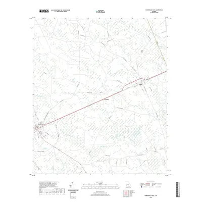
2020 Map of Homerville East
USGS Topo · Published 2020About this map
The Clinch County Courthouse in Homerville serves as the focal point for this survey of Clinch County, where the landscape is defined by the headwaters and tributaries of the Suwannee river system. Following the corridor of State Rte 38, small settlements like Traisville and Argyle punctuate a terrain of pine flatwoods and dense wetlands. The local geography is heavily influenced by depressions known locally as bays, including Isiac Bay, Bunkle Bay, and Collins Bay, which feed into drainage systems like Surveyors Creek and Little Suwannee Cr. A dense network of rural roads, such as Jesse Steedly Rd and Isham Bennet Rd, reflects the area's long history of family-based land ownership and timber activity. From the Dickerson Millpond in the west to the Ware Co Clinch Co line in the east, this map documents the persistent rural character and complex hydrology of the Georgia lowlands.
Find a feature on this map
75 named features on this map. Tap any name to fly to it.
Don’t see what you’re looking for? This feature index may not catch every label — zoom into the map to look around manually.
Map Details
Editions of this 2020 Homerville East Map
This is the sole edition of this map. No revisions or reprints were ever made.
Other maps of this area

1953 · Waycross
USGS Topo · 1:250,000

1954 · Valdosta
USGS Topo · 1:250,000

1958 · Valdosta
USGS Topo · 1:250,000

1958 · Waycross
USGS Topo · 1:250,000

1959 · Valdosta
USGS Topo · 1:250,000

1967 · Spooner
USGS Topo · 1:24,000

1967 · Pine Valley
USGS Topo · 1:24,000

1968 · Homerville East
USGS Topo · 1:24,000

1968 · Midway
USGS Topo · 1:24,000

1968 · Manor
USGS Topo · 1:24,000