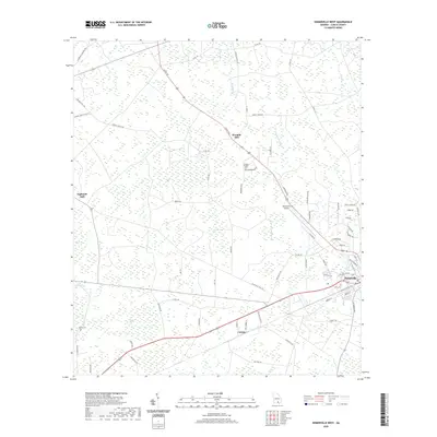
2020 Map of Homerville West
USGS Topo · Published 2020About this map
Homerville serves as the primary hub in this Georgia landscape, situated alongside the Homerville Airport. The surrounding terrain of Clinch County is defined by its low-lying hydrology, featuring numerous named "bays" or swampy depressions such as Whitehead Bay, Bear Bay, and Useless Bay. These wetlands are interconnected by small waterways like Woodyard Cr and Jones Creek, which feed into local features like the Dickerson Millpond. The settlement patterns here remain tied to the area's history of naval stores and timber, evidenced by the place names Eightmile Still and Fivemile Still along the rural road network. Several local burial grounds, including Pine Forest Cem, Holmes Chapel Cem, and North Cem, provide significant landmarks for genealogical research. The infrastructure is characterized by a mix of established routes like Arabia Courthouse Rd and more recently named developments like Whisperwood, illustrating the gradual expansion of the community outward from the town center.
Find a feature on this map
77 named features on this map. Tap any name to fly to it.
Don’t see what you’re looking for? This feature index may not catch every label — zoom into the map to look around manually.
Map Details
Editions of this 2020 Homerville West Map
This is the sole edition of this map. No revisions or reprints were ever made.
Other maps of this area

1953 · Waycross
USGS Topo · 1:250,000

1954 · Valdosta
USGS Topo · 1:250,000

1958 · Valdosta
USGS Topo · 1:250,000

1958 · Waycross
USGS Topo · 1:250,000

1959 · Valdosta
USGS Topo · 1:250,000

1968 · Homerville East
USGS Topo · 1:24,000

1968 · Midway
USGS Topo · 1:24,000

1968 · Cogdell
USGS Topo · 1:24,000

1971 · Du Pont
USGS Topo · 1:24,000

1971 · Stockton
USGS Topo · 1:24,000