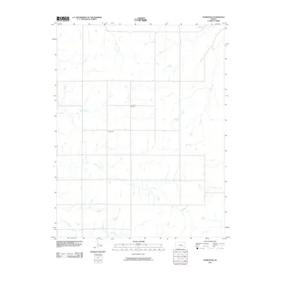
2010 Map of Homestead
USGS Topo · Published 2010About this map
The small settlement of Homestead sits at the heart of this landscape, a quiet intersection of rural Kansas life defined by the winding paths of numerous prairie waterways. This 2010 survey by the U.S. Geological Survey shows a terrain carved by the drainage systems of Coon Creek and Coyne Branch to the north, while Cedar Creek and Brush Creek dominate the southern half of the quadrangle. For genealogists and local historians, the Homestead Cemetery provides a central landmark for tracing family roots in this corner of Chase County. The map illustrates how local transportation routes were built to navigate the natural contours of the land and the irregular meanders of Rock Creek and Crocker Creek, reflecting a enduring pattern of agricultural land use in the Flint Hills region.
Find a feature on this map
8 named features on this map. Tap any name to fly to it.
Don’t see what you’re looking for? This feature index may not catch every label — zoom into the map to look around manually.
Map Details
Editions of this 2010 Homestead Map
This is the sole edition of this map. No revisions or reprints were ever made.
Other maps of this area

1898 · Cottonwood Falls
USGS Topo · 1:125,000

1955 · Hutchinson
USGS Topo · 1:250,000

1957 · Elmdale
USGS Topo · 1:24,000

1957 · Wonsevu
USGS Topo · 1:24,000

1957 · Cedar Point
USGS Topo · 1:24,000

1959 · Hutchinson
USGS Topo · 1:250,000
1962 · Florence SE
USGS Topo · 1:24,000
1967 · Cassoday
USGS Topo · 1:24,000
1967 · Matfield Green SE
USGS Topo · 1:24,000

1973 · Matfield Green
USGS Topo · 1:24,000