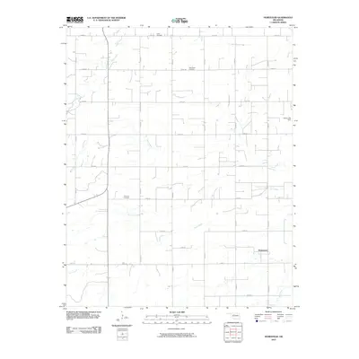
2010 Map of Homestead
USGS Topo · Published 2010About this map
Homestead sits as the central settlement hub in this part of Major County, anchoring a landscape defined by an orderly grid of section roads and several winding watercourses. The local heritage of this agricultural region is clearly marked by its burial grounds, including the Cedar Cemetery in the north and the Mennonite Cemetery and Plymouth Cemetery located further south. These sites, along with the numerous farmstead access points along routes like e0570 RD and n2560 RD, offer a detailed look at the rural settlement patterns in Oklahoma during the early twenty-first century.
Find a feature on this map
24 named features on this map. Tap any name to fly to it.
Don’t see what you’re looking for? This feature index may not catch every label — zoom into the map to look around manually.
Map Details
Editions of this 2010 Homestead Map
This is the sole edition of this map. No revisions or reprints were ever made.
Other maps of this area

1955 · Woodward
USGS Topo · 1:250,000

1958 · Woodward
USGS Topo · 1:250,000

1969 · Glass Mountains
USGS Topo · 1:24,000

1969 · Fairview SE
USGS Topo · 1:24,000

1969 · Fairview
USGS Topo · 1:24,000

1972 · Longdale
USGS Topo · 1:24,000

1972 · Canton
USGS Topo · 1:24,000

1972 · Southard
USGS Topo · 1:24,000

1972 · Okeene
USGS Topo · 1:24,000

1972 · Homestead
USGS Topo · 1:24,000