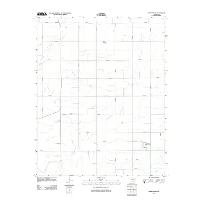
2012 Map of Homestead
USGS Topo · Published 2012About this map
Homestead sits at the heart of this rural Oklahoma landscape, characterized by a meticulous grid of section roads and a long-standing agricultural tradition. Several cemeteries, including the Mennonite Cem and Plymouth Cem, reflect the heritage of the local farming communities. Further north, the Cedar Cem marks another site of genealogical interest. The terrain is defined by the subtle drainage patterns of Sand Cr, Deep Cr, and Elm Cr, which meander through the prairie. This 2012 survey illustrates the enduring nature of the township-and-range system, showing how modern county roads like E0530 Rd and N2560 Rd follow the original survey lines laid out over a century prior.
Find a feature on this map
33 named features on this map. Tap any name to fly to it.
Don’t see what you’re looking for? This feature index may not catch every label — zoom into the map to look around manually.
Map Details
Editions of this 2012 Homestead Map
This is the sole edition of this map. No revisions or reprints were ever made.
Other maps of this area

1955 · Woodward
USGS Topo · 1:250,000

1958 · Woodward
USGS Topo · 1:250,000

1969 · Glass Mountains
USGS Topo · 1:24,000

1969 · Fairview SE
USGS Topo · 1:24,000

1969 · Fairview
USGS Topo · 1:24,000

1972 · Longdale
USGS Topo · 1:24,000

1972 · Canton
USGS Topo · 1:24,000

1972 · Southard
USGS Topo · 1:24,000

1972 · Okeene
USGS Topo · 1:24,000

1972 · Homestead
USGS Topo · 1:24,000