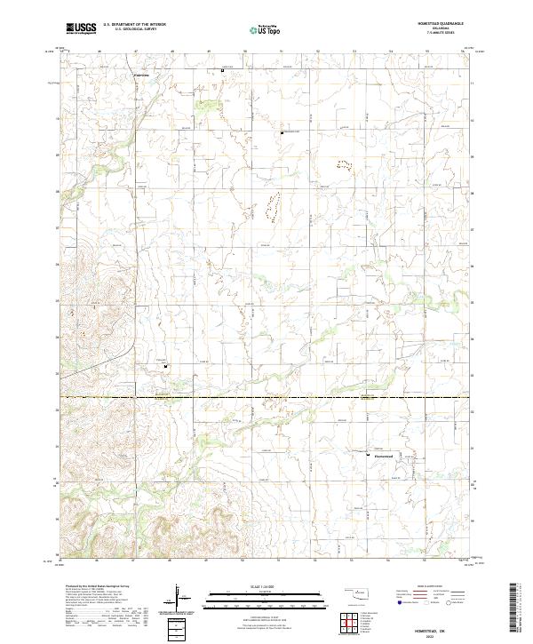
2022 Map of Homestead
USGS Topo · Published 2022About this map
The boundary between Major and Blaine Counties bisects this agricultural landscape, centered on the small settlement of Homestead. This region of western Oklahoma is characterized by its section-line road grid and the winding paths of seasonal waterways such as Sand Creek and Deep Creek. The map provides a clear look at the rural cemetery network that anchored these communities, including the Mennonite Cemetery and Plymouth Cemetery.
Find a feature on this map
41 named features on this map. Tap any name to fly to it.
Don’t see what you’re looking for? This feature index may not catch every label — zoom into the map to look around manually.
Map Details
Editions of this 2022 Homestead Map
This is the sole edition of this map. No revisions or reprints were ever made.
Other maps of this area

1955 · Woodward
USGS Topo · 1:250,000

1958 · Woodward
USGS Topo · 1:250,000

1969 · Glass Mountains
USGS Topo · 1:24,000

1969 · Fairview SE
USGS Topo · 1:24,000

1969 · Fairview
USGS Topo · 1:24,000

1972 · Longdale
USGS Topo · 1:24,000

1972 · Canton
USGS Topo · 1:24,000

1972 · Southard
USGS Topo · 1:24,000

1972 · Okeene
USGS Topo · 1:24,000

1972 · Homestead
USGS Topo · 1:24,000