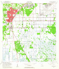
1956 Map of Homestead
USGS Topo · Published 1964About this map
Homestead Air Force Base dominates the northeastern landscape of this mid-century survey, reflecting the significant military footprint in South Florida during the Cold War. The urban cores of Homestead and Florida City are clearly defined by their grid systems, with development concentrated along the Florida East Coast Railway and Old Dixie Highway. This era captures a transition from agricultural groves to suburban residential pockets like Leisure City and Modello.
Find a feature on this map
29 named features on this map. Tap any name to fly to it.
Don’t see what you’re looking for? This feature index may not catch every label — zoom into the map to look around manually.
Map Details
Editions of this 1956 Homestead Map
3 editions found

Other maps of this area

1949 · Card Sound
USGS Topo · 1:24,000

1949 · Arsenicker Keys
USGS Topo · 1:24,000

1949 · Goulds
USGS Topo · 1:24,000

1949 · Perrine
USGS Topo · 1:24,000

1950 · Homestead
USGS Topo · 1:24,000

1950 · Glades
USGS Topo · 1:24,000

1956 · Goulds
USGS Topo · 1:24,000

1956 · Card Sound
USGS Topo · 1:24,000

1956 · Perrine
USGS Topo · 1:24,000

1956 · Grossman Hammock
USGS Topo · 1:24,000