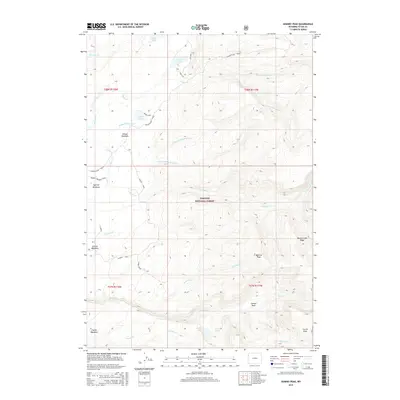
2015 Map of Hominy Peak
USGS Topo · Published 2015About this map
Hominy Peak stands as the central landmark of this Wyoming landscape, where the high-altitude drainage systems of the Targhee National Forest converge. The area is defined by a series of expansive meadow systems including Gibson Meadows, Squirrel Meadows, Jackass Meadows, and Coyote Meadows, which likely served as critical transit points or seasonal camps. The complex hydrology is anchored by Loon Lake and Moose Lake, feeding a network of alpine streams such as N Boone Cr and Middle Boone Cr. Traces of human activity and access are evidenced by the Ashton-Flagg Ranch road and the Jackass Loop, which provide a framework for navigating the terrain between Conant Basin and Boone Creek Ridge. The map details the transition from lush bottomlands to significant elevations like Carrot Knoll, offering a precise record of the backcountry before the mid-2010s.
Find a feature on this map
36 named features on this map. Tap any name to fly to it.
Don’t see what you’re looking for? This feature index may not catch every label — zoom into the map to look around manually.
Map Details
Editions of this 2015 Hominy Peak Map
This is the sole edition of this map. No revisions or reprints were ever made.
Other maps of this area

1886 · Shoshone
USGS Topo · 1:125,000

1888 · Shoshone
USGS Topo · 1:125,000

1895 · Shoshone
USGS Topo · 1:125,000

1899 · Grand Teton
USGS Topo · 1:125,000

1901 · Shoshone
USGS Topo · 1:125,000

1901 · Grand Teton
USGS Topo · 1:125,000

1908 · Shoshone
USGS Topo · 1:125,000

1911 · Shoshone
USGS Topo · 1:125,000

1955 · Ashton
USGS Topo · 1:250,000

1955 · Driggs
USGS Topo · 1:250,000