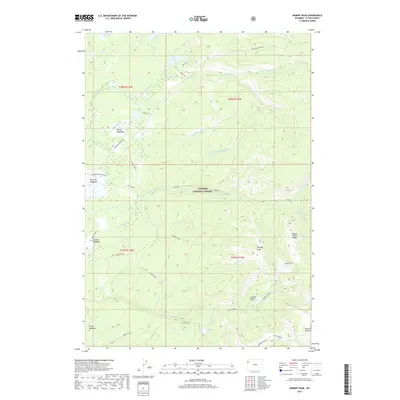
2017 Map of Hominy Peak
USGS Topo · Published 2017About this map
Targhee National Forest dominates this Wyoming landscape, where high-altitude water systems and backcountry routes define the geography of Teton County. The complex drainage patterns of N Boone Cr and S Boone Cr create a network of forks and meadows, including the prominent Gibson Meadows and Squirrel Meadows. Historically significant cattle and pack routes are visible through labeled paths like Jackass Loop and Conant Pass, which navigate the steep terrain near the Teton Crest. Evidence of human settlement in this wilderness is sparse but distinct, centered around locations such as Squirrel Meadows Ranch and Ashton-Flagg Ranch. The map captures a transition from the lower creek basins to the alpine heights of Hominy Peak and Boone Creek Ridge, providing a clear view of the hydrological connectivity between alpine lakes like Rock Lake and Loon Lake.
Find a feature on this map
51 named features on this map. Tap any name to fly to it.
Don’t see what you’re looking for? This feature index may not catch every label — zoom into the map to look around manually.
Map Details
Editions of this 2017 Hominy Peak Map
This is the sole edition of this map. No revisions or reprints were ever made.
Other maps of this area

1886 · Shoshone
USGS Topo · 1:125,000

1888 · Shoshone
USGS Topo · 1:125,000

1895 · Shoshone
USGS Topo · 1:125,000

1899 · Grand Teton
USGS Topo · 1:125,000

1901 · Shoshone
USGS Topo · 1:125,000

1901 · Grand Teton
USGS Topo · 1:125,000

1908 · Shoshone
USGS Topo · 1:125,000

1911 · Shoshone
USGS Topo · 1:125,000

1955 · Ashton
USGS Topo · 1:250,000

1955 · Driggs
USGS Topo · 1:250,000