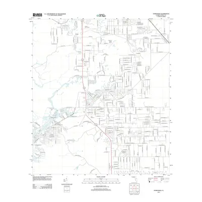
2012 Map of Homosassa
USGS Topo · Published 2012About this map
Homosassa Springs forms the centerpiece of this coastal Florida landscape, where freshwater systems meet the brackish reaches of the Homosassa River and Halls River. The area around Cutlers and the surrounding Citrus County wetlands shows a dense network of residential streets and local landmarks, including the Homosassa Water Tower and the Stage Stand Cem. This 2012 survey captures the region's unique aviation footprint with both the Crystal River Airport and the smaller Post Oak Ranch Airport situated among the evolving subdivisions. Waterways dominate the western reaches, with Buzzard Point overlooking the complex confluence of Game Cr, Otter Cr, and Mason Cr. The map's detail provides a clear view of how mid-century platting and contemporary development have integrated with the natural spring-fed hydrology of the Gulf Coast.
Find a feature on this map
99 named features on this map. Tap any name to fly to it.
Don’t see what you’re looking for? This feature index may not catch every label — zoom into the map to look around manually.
Map Details
Editions of this 2012 Homosassa Map
This is the sole edition of this map. No revisions or reprints were ever made.
Other maps of this area

1895 · Tsala Apopka
USGS Topo · 1:62,500

1954 · Lecanto
USGS Topo · 1:24,000

1954 · Homosassa
USGS Topo · 1:24,000

1954 · Holder
USGS Topo · 1:24,000

1954 · Chassahowitzka Bay
USGS Topo · 1:24,000

1954 · Crystal River
USGS Topo · 1:24,000

1954 · Brooksville NW
USGS Topo · 1:24,000

1954 · Chassahowitzka
USGS Topo · 1:24,000

1954 · Red Level
USGS Topo · 1:24,000

1954 · Ozello
USGS Topo · 1:24,000