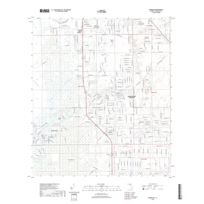
2018 Map of Homosassa
USGS Topo · Published 2018About this map
Homosassa Springs and the surrounding Citrus County wetlands define this coastal landscape, where the Homosassa River and Halls River wind through a complex network of marshes toward the Gulf. The geography transitions from the dense residential developments of Homosassa Springs and Homosassa to the sprawling Chassahowitzka Swamp in the south. The map documents the region's infrastructure, from aviation hubs like the Crystal River Airport-Captain Tom Davis Field and Post Oak Ranch Airport to local landmarks including the Stage Stand Cem. Notable water features such as Mason Creek and Game Creek provide essential context for the area's hydrology, while coastal markers like Buzzard Point delineate the shoreline's edge. This record offers a clear view of the modern road network, including N Suncoast Blvd, as it intersects these established Florida communities.
Find a feature on this map
256 named features on this map. Tap any name to fly to it.
Don’t see what you’re looking for? This feature index may not catch every label — zoom into the map to look around manually.
Map Details
Editions of this 2018 Homosassa Map
This is the sole edition of this map. No revisions or reprints were ever made.
Other maps of this area

1895 · Tsala Apopka
USGS Topo · 1:62,500

1954 · Lecanto
USGS Topo · 1:24,000

1954 · Homosassa
USGS Topo · 1:24,000

1954 · Holder
USGS Topo · 1:24,000

1954 · Chassahowitzka Bay
USGS Topo · 1:24,000

1954 · Crystal River
USGS Topo · 1:24,000

1954 · Brooksville NW
USGS Topo · 1:24,000

1954 · Chassahowitzka
USGS Topo · 1:24,000

1954 · Red Level
USGS Topo · 1:24,000

1954 · Ozello
USGS Topo · 1:24,000