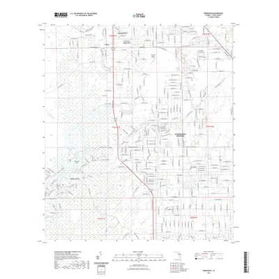
2021 Map of Homosassa
USGS Topo · Published 2021About this map
Homosassa Springs and the coastal lowlands of Citrus County are defined by a complex network of spring-fed waterways and sprawling wetlands. This 2021 edition captures the area at a point of significant suburban growth, particularly along the W Grover Cleveland Blvd corridor, while maintaining the wilder character of the south where the Chassahowitzka Swamp dominates the terrain. Genealogists and local researchers will find the location of the Stage Stand Cem and The Fountains Memorial Park useful for mapping local family histories. The landscape transitions from the developed grids of Crystal River and Homosassa to the intricate, tidally influenced shorelines of Halls River and Mason Creek. Aviation history is noted by the presence of Crystal River Airport-Captain Tom Davis Field and the smaller Post Oak Ranch Airport, illustrating the region's accessibility for both commercial and private flight.
Find a feature on this map
141 named features on this map. Tap any name to fly to it.
Don’t see what you’re looking for? This feature index may not catch every label — zoom into the map to look around manually.
Map Details
Editions of this 2021 Homosassa Map
This is the sole edition of this map. No revisions or reprints were ever made.
Other maps of this area

1895 · Tsala Apopka
USGS Topo · 1:62,500

1954 · Lecanto
USGS Topo · 1:24,000

1954 · Homosassa
USGS Topo · 1:24,000

1954 · Holder
USGS Topo · 1:24,000

1954 · Chassahowitzka Bay
USGS Topo · 1:24,000

1954 · Crystal River
USGS Topo · 1:24,000

1954 · Brooksville NW
USGS Topo · 1:24,000

1954 · Chassahowitzka
USGS Topo · 1:24,000

1954 · Red Level
USGS Topo · 1:24,000

1954 · Ozello
USGS Topo · 1:24,000