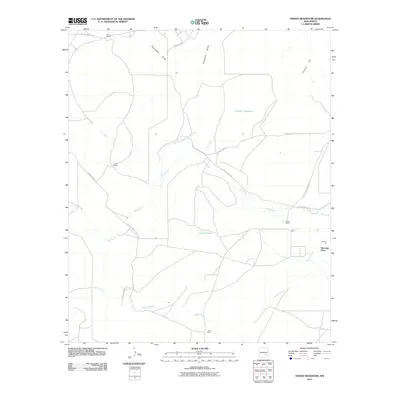
2010 Map of Hondo Reservoir
USGS Topo · Published 2010About this map
Rio Hondo and its managed water systems define this arid landscape in Chaves County, where early 21st-century irrigation infrastructure remains central to local ranching operations. The Hondo Reservoir Diversion Canal and an associated Outlet Canal connect the river to the Hondo Reservoir, a critical management point in this dry basin. The map reveals a pattern of dispersed rural occupation, with named locations such as Bloom Ranch, Woods Ranch, and Coles Camp marking the territory along Rio Hondo and Rocky Arroyo.
Find a feature on this map
21 named features on this map. Tap any name to fly to it.
Don’t see what you’re looking for? This feature index may not catch every label — zoom into the map to look around manually.
Map Details
Editions of this 2010 Hondo Reservoir Map
This is the sole edition of this map. No revisions or reprints were ever made.
Other maps of this area

1949 · Hondo Reservoir
USGS Topo · 1:24,000

1949 · Peters Lake
USGS Topo · 1:24,000

1949 · Roswell North
USGS Topo · 1:24,000

1949 · Roswell South
USGS Topo · 1:24,000

1949 · Juan Lake
USGS Topo · 1:24,000

1949 · Corn Ranch
USGS Topo · 1:24,000

1950 · Corn Ranch
USGS Topo · 1:24,000

1955 · Roswell
USGS Topo · 1:250,000

1956 · Diamond A Ranch
USGS Topo · 1:24,000

1958 · Roswell
USGS Topo · 1:250,000