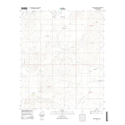
2013 Map of Hondo Reservoir
USGS Topo · Published 2013About this map
Sherman Place and a network of irrigation works define this high-desert landscape in Chaves County, where water management is central to the local economy. The geography is structured around the Rio Hondo, which is supported by significant engineering features including the Hondo Reservoir, the Hondo Reservoir Diversion Canal, and the Two Rivers Reservoir. These systems, part of the Hondo Irrigation Project, highlight the region's reliance on diverting water to support agriculture and ranching in an arid environment.
Find a feature on this map
28 named features on this map. Tap any name to fly to it.
Don’t see what you’re looking for? This feature index may not catch every label — zoom into the map to look around manually.
Map Details
Editions of this 2013 Hondo Reservoir Map
This is the sole edition of this map. No revisions or reprints were ever made.
Other maps of this area

1949 · Hondo Reservoir
USGS Topo · 1:24,000

1949 · Peters Lake
USGS Topo · 1:24,000

1949 · Roswell North
USGS Topo · 1:24,000

1949 · Roswell South
USGS Topo · 1:24,000

1949 · Juan Lake
USGS Topo · 1:24,000

1949 · Corn Ranch
USGS Topo · 1:24,000

1950 · Corn Ranch
USGS Topo · 1:24,000

1955 · Roswell
USGS Topo · 1:250,000

1956 · Diamond A Ranch
USGS Topo · 1:24,000

1958 · Roswell
USGS Topo · 1:250,000