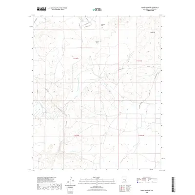
2020 Map of Hondo Reservoir
USGS Topo · Published 2020About this map
The Rio Hondo drainage system defines this Chaves County landscape, where complex water management infrastructure supports the arid Chaves County environment. The hydrology of the region is centered on the Hondo Reservoir Diversion Canal and the Outlet Canal, tracing a network designed to manage seasonal flows. Natural drainage features including Blackwater Draw, Eightmile Draw, and Rocky Arroyo converge across the basin, while Duncan Tank provides a localized catchment point. Higher elevations like Sixmile Hill overlook the plains, which are subdivided by a modern grid of roads such as Tierra Grande Blvd and Los Padrinos Rd. Historical transportation routes are represented by Old Hondo Channel Rd and Two Rivers Dam Rd, following the contours of the riverbed and engineering works that dominate the local geography.
Find a feature on this map
24 named features on this map. Tap any name to fly to it.
Don’t see what you’re looking for? This feature index may not catch every label — zoom into the map to look around manually.
Map Details
Editions of this 2020 Hondo Reservoir Map
This is the sole edition of this map. No revisions or reprints were ever made.
Other maps of this area

1949 · Hondo Reservoir
USGS Topo · 1:24,000

1949 · Peters Lake
USGS Topo · 1:24,000

1949 · Roswell North
USGS Topo · 1:24,000

1949 · Roswell South
USGS Topo · 1:24,000

1949 · Juan Lake
USGS Topo · 1:24,000

1949 · Corn Ranch
USGS Topo · 1:24,000

1950 · Corn Ranch
USGS Topo · 1:24,000

1955 · Roswell
USGS Topo · 1:250,000

1956 · Diamond A Ranch
USGS Topo · 1:24,000

1958 · Roswell
USGS Topo · 1:250,000