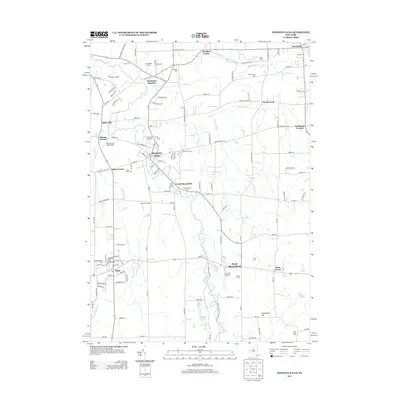
2013 Map of Honeoye Falls
USGS Topo · Published 2013About this map
Honeoye Creek carves a winding path through this western New York landscape, anchoring several established villages and historical hamlets. The settlement of Honeoye Falls serves as a primary hub, while smaller crossroads like Sibleyville, North Bloomfield, and Mendon Center define the surrounding rural character. A high concentration of local burial grounds, including the Old Methodist Cem and the Quaker Cem, provide significant markers of the area's early family history and religious heritage.
Find a feature on this map
127 named features on this map. Tap any name to fly to it.
Don’t see what you’re looking for? This feature index may not catch every label — zoom into the map to look around manually.
Map Details
Editions of this 2013 Honeoye Falls Map
This is the sole edition of this map. No revisions or reprints were ever made.
Other maps of this area

1895 · Rochester
USGS Topo · 1:62,500

1898 · Rochester
USGS Topo · 1:62,500

1900 · Macedon
USGS Topo · 1:62,500

1900 · Canandaigua
USGS Topo · 1:62,500

1901 · Honeoye
USGS Topo · 1:62,500

1903 · Canandaigua
USGS Topo · 1:62,500

1904 · Honeoye
USGS Topo · 1:62,500

1912 · Rochester
USGS Topo · 1:62,500

1920 · Rochester
USGS Topo · 1:62,500

1931 · Mendon Ponds
USGS Topo · 1:24,000