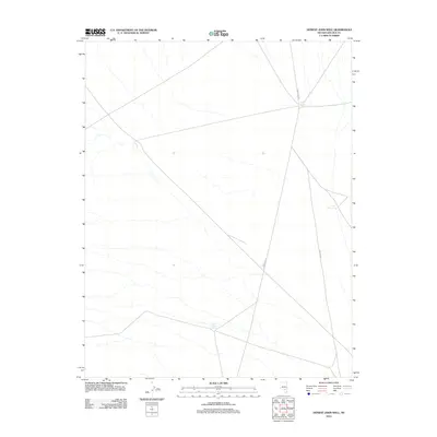
2012 Map of Honest John Well
USGS Topo · Published 2012About this map
Honest John Spring sits as a primary water source in this arid corner of Lincoln County, defining the location's character long before modern mapping. The landscape is marked by the sparse distribution of life-sustaining features, including Smith Spring and the Able Reservoir, which serve as vital hubs in the high desert environment. This 2012 survey captures a remote network of local routes such as Gunderson Rd and Shadow Wls, which navigate the basin terrain. These features reflect the long-standing importance of reliable water and established trails for ranching or travel in this part of Nevada, where the geography dictates the placement of infrastructure and seasonal activity.
Find a feature on this map
5 named features on this map. Tap any name to fly to it.
Don’t see what you’re looking for? This feature index may not catch every label — zoom into the map to look around manually.
Map Details
Editions of this 2012 Honest John Well Map
This is the sole edition of this map. No revisions or reprints were ever made.
Other maps of this area

1942 · Penoyer Valley
USGS Topo · 1:125,000

1952 · White Blotch Springs
USGS Topo · 1:62,500

1954 · Caliente
USGS Topo · 1:250,000

1959 · Caliente
USGS Topo · 1:250,000

1964 · Tempiute Mtn
USGS Topo · 1:62,500

1985 · McCutchen Spring
USGS Topo · 1:24,000
1985 · Black Top
USGS Topo · 1:24,000
1985 · Quinn Canyon Springs
USGS Topo · 1:24,000

1985 · Worthington Peak SW
USGS Topo · 1:24,000
1985 · Quinn Canyon Springs NW
USGS Topo · 1:24,000