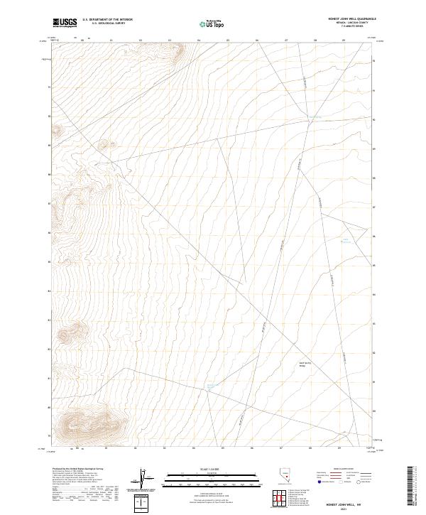
2021 Map of Honest John Well
USGS Topo · Published 2021About this map
Sand Spring Valley defines the arid character of this Lincoln County landscape, showing the persistent importance of isolated water sources in the Nevada desert. The terrain is marked by essential hydrological features such as Honest John Spring and Smith Spring, which serve as vital landmarks for navigation and land use in an otherwise dry expanse. The presence of Able Reservoir near the eastern boundary suggests managed water collection, likely supporting the sparse grazing operations common to this region. Movement through the valley follows established backcountry routes like Gunderson Rd and Shadow Wells, which connect the scattered water points and define the limited human infrastructure in this high-desert environment. This map illustrates how the placement of springs and wells dictates the geography of travel and land management far from urban centers.
Find a feature on this map
10 named features on this map. Tap any name to fly to it.
Don’t see what you’re looking for? This feature index may not catch every label — zoom into the map to look around manually.
Map Details
Editions of this 2021 Honest John Well Map
This is the sole edition of this map. No revisions or reprints were ever made.
Other maps of this area

1942 · Penoyer Valley
USGS Topo · 1:125,000

1952 · White Blotch Springs
USGS Topo · 1:62,500

1954 · Caliente
USGS Topo · 1:250,000

1959 · Caliente
USGS Topo · 1:250,000

1964 · Tempiute Mtn
USGS Topo · 1:62,500

1985 · McCutchen Spring
USGS Topo · 1:24,000
1985 · Black Top
USGS Topo · 1:24,000
1985 · Quinn Canyon Springs
USGS Topo · 1:24,000

1985 · Worthington Peak SW
USGS Topo · 1:24,000
1985 · Quinn Canyon Springs NW
USGS Topo · 1:24,000