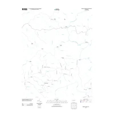
2013 Map of Honey Creek
USGS Topo · Published 2013About this map
Mount Helen and the surrounding plateau topographies of the Big South Fork region are defined by a complex network of deep drainages and rugged high ground. Smaller settlements like Speck, Zenith, and Goad are connected by a web of local roads, such as Old Mount Helen Rd and Cecil Stewart Rd, which follow the natural contours of ridges like Long Ridge and Hurricane Ridge. This 2013 survey illustrates the modern recreation-heavy character of the landscape, featuring the Bandy Creek Campground and the Honey Creek Trailhead OVLK. The Big S Fork Cumberland River serves as a primary geographic anchor, punctuated by distinctive water features including Washing Machine Rapids, O and W Rapids, and Jakes Hole. A history of river access is evident at Leatherwood Ford and the crossing at Burnt Mill Bridge.
Find a feature on this map
85 named features on this map. Tap any name to fly to it.
Don’t see what you’re looking for? This feature index may not catch every label — zoom into the map to look around manually.
Map Details
Editions of this 2013 Honey Creek Map
This is the sole edition of this map. No revisions or reprints were ever made.
Other maps of this area

1895 · Wartburg
USGS Topo · 1:125,000

1896 · Wartburg
USGS Topo · 1:125,000

1934 · Barthell
USGS Topo · 1:62,500

1934 · Pall Mall
USGS Topo · 1:62,500

1952 · Helenwood
USGS Topo · 1:24,000

1952 · Honey Creek
USGS Topo · 1:24,000

1952 · Rugby
USGS Topo · 1:24,000
1952 · Robbins
USGS Topo · 1:24,000

1954 · Stockton
USGS Topo · 1:24,000

1954 · Burrville
USGS Topo · 1:24,000