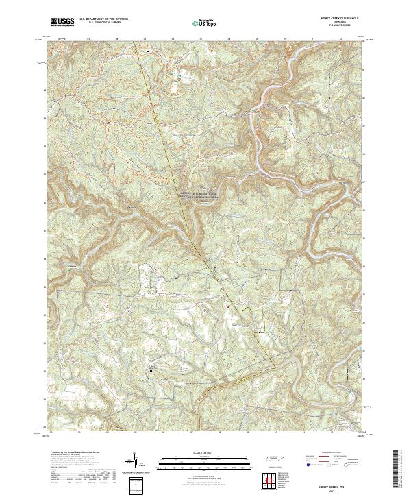
2022 Map of Honey Creek
USGS Topo · Published 2022About this map
Big South Fork National River and Recreation Area dominates this Scott County landscape, where the deeply carved gorge of the Big South Fork Cumberland River meets its numerous tributaries. The map reveals a transition from the plateau settlements like Gernt and Zenith to the intricate river system below. Local history is anchored by sites such as the Blevins Cem and the John Litton Farm Hike Loop, marking the legacy of subsistence farming and early families in the region.
Find a feature on this map
108 named features on this map. Tap any name to fly to it.
Don’t see what you’re looking for? This feature index may not catch every label — zoom into the map to look around manually.
Map Details
Editions of this 2022 Honey Creek Map
This is the sole edition of this map. No revisions or reprints were ever made.
Other maps of this area

1895 · Wartburg
USGS Topo · 1:125,000

1896 · Wartburg
USGS Topo · 1:125,000

1934 · Barthell
USGS Topo · 1:62,500

1934 · Pall Mall
USGS Topo · 1:62,500

1952 · Helenwood
USGS Topo · 1:24,000

1952 · Honey Creek
USGS Topo · 1:24,000

1952 · Rugby
USGS Topo · 1:24,000
1952 · Robbins
USGS Topo · 1:24,000

1954 · Stockton
USGS Topo · 1:24,000

1954 · Burrville
USGS Topo · 1:24,000