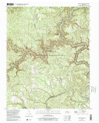
2000 Map of Honey Creek
USGS Topo · Published 2001About this map
The Big South Fork National River and Recreation Area dominates this landscape, where the deeply entrenched Big South Fork Cumberland River meets its major tributaries. The confluence of the Clear Fork and White Oak Cr marks a significant hydrologic junction near Burnt Mill Bridge. This terrain, shared between Scott, Fentress, and Morgan Counties, preserves evidence of earlier rural life and industry, such as the Old Railroad Grade winding near the settlement of Zenith. Local history is anchored by several small community institutions, including Honey Creek Church, Mt Helen Ch, and the Opossum Rock School. The map reflects a period where traditional upland settlements and logging-era infrastructure transitioned into a preserved wilderness, with the Scott State Forest protecting the high timber above the river gorges.
Find a feature on this map
34 named features on this map. Tap any name to fly to it.
Don’t see what you’re looking for? This feature index may not catch every label — zoom into the map to look around manually.
Map Details
Editions of this 2000 Honey Creek Map
This is the sole edition of this map. No revisions or reprints were ever made.
Other maps of this area

1895 · Wartburg
USGS Topo · 1:125,000

1896 · Wartburg
USGS Topo · 1:125,000

1934 · Barthell
USGS Topo · 1:62,500

1934 · Pall Mall
USGS Topo · 1:62,500

1952 · Helenwood
USGS Topo · 1:24,000

1952 · Honey Creek
USGS Topo · 1:24,000

1952 · Rugby
USGS Topo · 1:24,000
1952 · Robbins
USGS Topo · 1:24,000

1954 · Stockton
USGS Topo · 1:24,000

1954 · Burrville
USGS Topo · 1:24,000