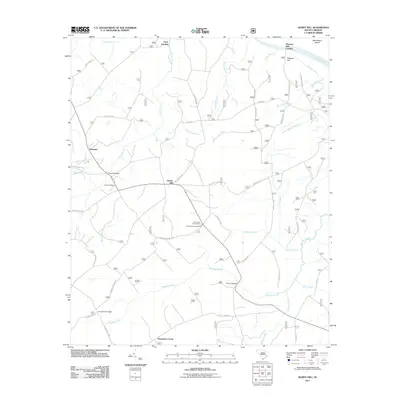
2011 Map of Honey Hill
USGS Topo · Published 2011About this map
Honey Hill and its surrounding wetlands define this coastal South Carolina landscape, where numerous blackwater creeks like Echaw Creek and Wambaw Creek drain toward the Santee River. The map documents a rural network of river access points such as Pitch Landing and Pleasant Hill Landing, which hint at the region's historic reliance on water-based transport and fishing. Significant local landmarks include the Honey Hill Lookout Tower and several named crossings, including Charlie Bridges and Thompson Bridges. The settlement patterns at Newland and Thompson Corner are connected by a web of forest routes like Echaw Rd and Victor Lincoln Rd, while more specialized sites like the Honey Hill Hunt Camp reflect the area's recreational land use. This topography provides a detailed record of the drainage basins and small communities within the Francis Marion National Forest area as they appeared in 2011.
Find a feature on this map
45 named features on this map. Tap any name to fly to it.
Don’t see what you’re looking for? This feature index may not catch every label — zoom into the map to look around manually.
Map Details
Editions of this 2011 Honey Hill Map
This is the sole edition of this map. No revisions or reprints were ever made.
Other maps of this area

1942 · Cedar Creek
USGS Topo · 1:24,000

1942 · Mc Clellanville
USGS Topo · 1:24,000

1942 · Honey Hill
USGS Topo · 1:24,000

1943 · Shulerville
USGS Topo · 1:24,000

1943 · Kilsock Bay
USGS Topo · 1:24,000

1943 · Jamestown
USGS Topo · 1:24,000

1943 · Santee
USGS Topo · 1:24,000

1943 · Awendaw
USGS Topo · 1:24,000

1943 · Ocean Bay
USGS Topo · 1:24,000

1949 · Georgetown
USGS Topo · 1:250,000