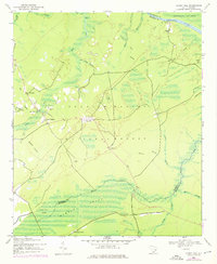
1942 Map of Honey Hill
USGS Topo · Published 1976About this map
Francis Marion National Forest defines this lowcountry landscape, where dense swamp drainage and small agricultural clearings meet at the intersection of Berkeley, Charleston, and Georgetown counties. The settlement of Honey Hill serves as a central point, supported by local landmarks like the Honey Hill Lookout Tower and the Wesley Sch church and schoolhouse. This map, based on 1942 data with revisions from the 1970s, illustrates a rural economy tied to the river and timberlands, with small outposts such as Newland, Charley Bridges, and Thompson Corner connected by winding light-duty roads.
Find a feature on this map
33 named features on this map. Tap any name to fly to it.
Don’t see what you’re looking for? This feature index may not catch every label — zoom into the map to look around manually.
Map Details
Editions of this 1942 Honey Hill Map
3 editions found
Other maps of this area

1942 · Cedar Creek
USGS Topo · 1:24,000

1942 · Mc Clellanville
USGS Topo · 1:24,000

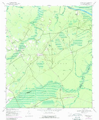
1942 · Honey Hill
USGS Topo · 1:24,000

1943 · Shulerville
USGS Topo · 1:24,000

1943 · Kilsock Bay
USGS Topo · 1:24,000

1943 · Jamestown
USGS Topo · 1:24,000

1943 · Santee
USGS Topo · 1:24,000

1943 · Awendaw
USGS Topo · 1:24,000

1943 · Ocean Bay
USGS Topo · 1:24,000

1949 · Georgetown
USGS Topo · 1:250,000