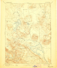
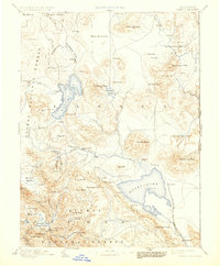
1893 Map of Honey Lake
USGS Topo · Published 1906About this map
Honey Lake and its surrounding high-desert basins are captured here during a period of late-19th-century settlement and early railway development. Surveyed in 1882, the map shows Susanville as a primary hub where Gold Run and Piute Creek meet the Susan River. The geography is defined by vast volcanic plateaus like the Madeline Plains and large seasonal water bodies including Eagle Lake and Horse Lake.
Find a feature on this map
97 named features on this map. Tap any name to fly to it.
Don’t see what you’re looking for? This feature index may not catch every label — zoom into the map to look around manually.
Map Details
Editions of this 1893 Honey Lake Map
6 editions found

Other maps of this area

1886 · Alturas
USGS Topo · 1:250,000

1886 · Honey Lake
USGS Topo · 1:250,000

1886 · Lassen Peak
USGS Topo · 1:250,000

1886 · Modoc Lava Bed
USGS Topo · 1:250,000

1886 · Granite Range
USGS Topo · 1:250,000

1888 · Bidwell Bar
USGS Topo · 1:125,000

1889 · Long Valley
USGS Topo · 1:250,000

1890 · Sierraville
USGS Topo · 1:125,000

1891 · Bidwell Bar
USGS Topo · 1:125,000

1891 · Downieville
USGS Topo · 1:125,000