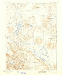
1893 Map of Honey Lake
USGS Topo · Published 1930About this map
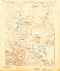
Honey Lake and its high-desert basin define this late nineteenth-century landscape, a region of interior drainage where water determines the pattern of settlement. To the northwest, the deep waters of Eagle Lake contrast with the ephemeral Horse Lake, while the Susan River provides a vital corridor for the burgeoning community at Susanville. The map illustrates a transitional period in northeastern California, as ranching and timber interests established outposts like Merrillville and Janesville along the edges of the Madeline Plains.
Find a feature on this map
93 named features on this map. Tap any name to fly to it.
Don’t see what you’re looking for? This feature index may not catch every label — zoom into the map to look around manually.
Map Details
Editions of this 1893 Honey Lake Map
6 editions found

Other maps of this area

1886 · Alturas
USGS Topo · 1:250,000

1886 · Honey Lake
USGS Topo · 1:250,000

1886 · Lassen Peak
USGS Topo · 1:250,000

1886 · Modoc Lava Bed
USGS Topo · 1:250,000

1886 · Granite Range
USGS Topo · 1:250,000

1888 · Bidwell Bar
USGS Topo · 1:125,000

1889 · Long Valley
USGS Topo · 1:250,000

1890 · Sierraville
USGS Topo · 1:125,000

1891 · Bidwell Bar
USGS Topo · 1:125,000

1891 · Downieville
USGS Topo · 1:125,000