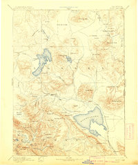
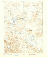
1893 Map of Honey Lake
USGS Topo · Published 1909About this map
Susanville serves as a central hub in this high-altitude landscape where the Susan River flows eastward toward the Great Basin. This 1880s survey, reprinted at the turn of the century, captures a transitional era of ranching and early settlement across Lassen and Plumas counties. The geography is dominated by large, terminal lake basins, including the expansive Honey Lake and the irregular shoreline of Eagle Lake. To the north, the Madeline Plains stretch toward the Boundary Line, while the southern reaches reveal the productive meadows of Indian Valley. Small settlements and family ranch sites like Janesville, Buntingville, and Amedee are mapped alongside pioneer infrastructure such as the Mill on Gold Run and the isolated Hot Springs near Shaffer Peak. The map illustrates the early connectivity between mountain valleys and the arid flats of the California Nevada border.
Find a feature on this map
101 named features on this map. Tap any name to fly to it.
Don’t see what you’re looking for? This feature index may not catch every label — zoom into the map to look around manually.
Map Details
Editions of this 1893 Honey Lake Map
6 editions found

Other maps of this area

1886 · Alturas
USGS Topo · 1:250,000

1886 · Honey Lake
USGS Topo · 1:250,000

1886 · Lassen Peak
USGS Topo · 1:250,000

1886 · Modoc Lava Bed
USGS Topo · 1:250,000

1886 · Granite Range
USGS Topo · 1:250,000

1888 · Bidwell Bar
USGS Topo · 1:125,000

1889 · Long Valley
USGS Topo · 1:250,000

1890 · Sierraville
USGS Topo · 1:125,000

1891 · Bidwell Bar
USGS Topo · 1:125,000

1891 · Downieville
USGS Topo · 1:125,000