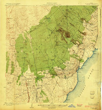
1924 Map of Honuapo
USGS Topo · Published 1924About this map
Naalehu and the surrounding sugar-growing landscape of the Kau District are captured here during a period of transition in the early 1920s. The map illustrates a complex network of plantation infrastructure, including numerous specialized camps such as Makanau Camp, Dairy Camp, and Kaalaiki Camp that housed workers near the fields and mills. Along the coast, the port at Honuapo and the nearby Honuapo Bay served as vital links for the regional economy, while the Volcano Road provided the primary inland thoroughfare.
Find a feature on this map
104 named features on this map. Tap any name to fly to it.
Don’t see what you’re looking for? This feature index may not catch every label — zoom into the map to look around manually.
Map Details
Editions of this 1924 Honuapo Map
3 editions found
Other maps of this area

1921 · Kilauea
USGS Topo · 1:62,500

1923 · Pahala
USGS Topo · 1:62,500

1924 · Kalae
USGS Topo · 1:62,500

1924 · Kilauea
USGS Topo · 1:62,500

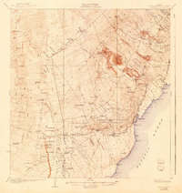
1924 · Honuapo
USGS Topo · 1:62,500

1928 · Mauna Loa
USGS Topo · 1:62,500

1928 · Hoopuloa
USGS Topo · 1:62,500

1954 · Hawaii South
USGS Topo · 1:250,000

1959 · Hawaii South
USGS Topo · 1:250,000

1961 · Hawaii South
USGS Topo · 1:250,000